About Us
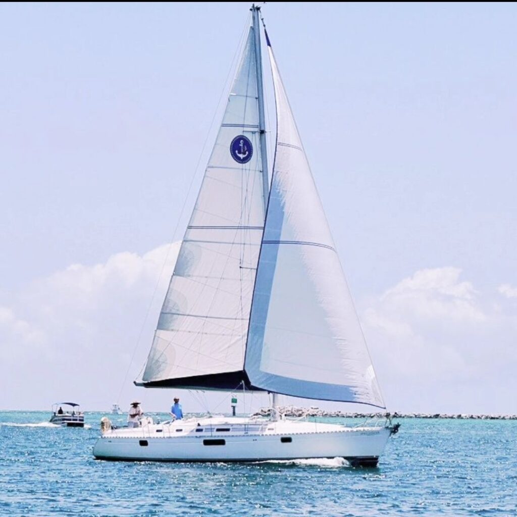
East Pass Sailing company operates a 1993 M445 Beneteau Sailing Yacht for charter in Destin, Florida. The Space Dancer, a 45 foot mono-hull sloop built for the Moorings charter fleet in the British Virgin Islands, was equipped with chartering in mind. Locals and visitors can book daytime sailing cruises, swimming, dolphin tours, sailing lessons, multi-day excursions, and sunset tours all year long out of Pelican Adventures Marina in the Destin Harbor.
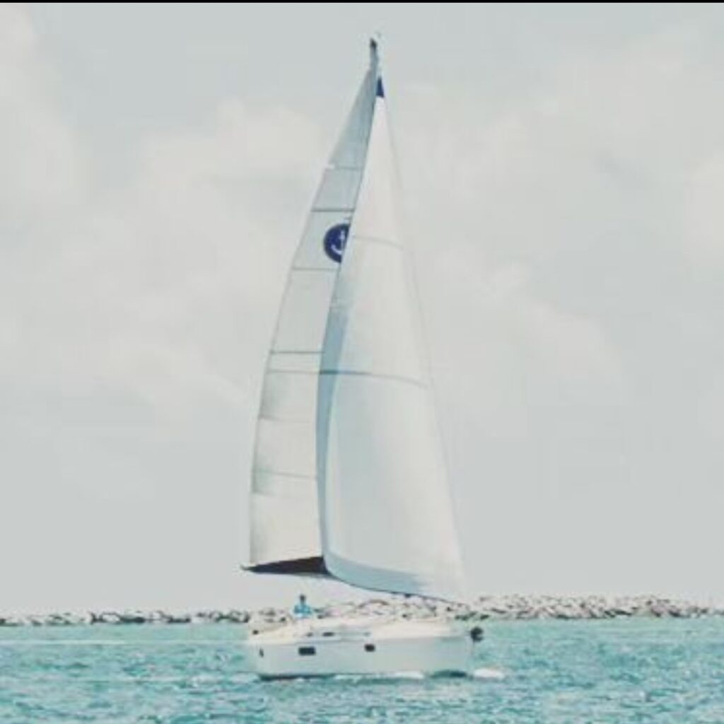
Specifically designated a Moorings 445, her design is based off of Bruce Farr’s production model the Oceanis 440. Designed for speed without sacrificing comfort, the Space Dancer’s tall sails and sleek hull are a unique and beloved fixture in the Destin tour fleet. Boasting 3 bedrooms and 3 bathrooms, galley kitchen and salon, spacious seating, and an open deck topside make the Space Dancer a great pick for sailing in Destin.
Our boat is crewed by a minimum of one captain and one mate on any charter. Our captains all hold Merchant Mariner Credentials issued by the US Coast Guard that authorizes them to carry passengers for hire. All of our crew and our vessel are evaluated and inspected monthly in drills and safety procedures.
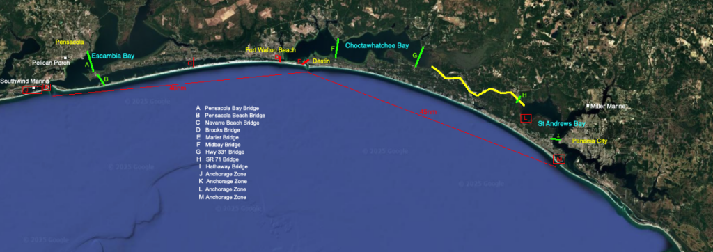
The Space Dancer primarily operates within the waters of the Destin Harbor, East Pass, and within 5nm of the East Pass sea buoy. She occasionally visits the neighboring cities of Mobile, Pensacola, Panama City, Port St Joe, Appalachicola, Carabelle, and any of the waters in between, for chartering, regular maintenance, and recreation.
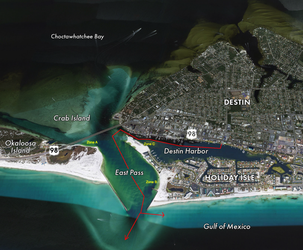
Shown below is the normal route from the dock to the Gulf. After departing from Pelican Adventures Marina, the Dancer proceeds West towards the Destin bridge before turning South around Norriego Point ( the point of land to the NorthWest of Zone C ). Once in the channel of the East Pass the Dancer proceeds SouthSouthEast before entering the open water of the Gulf.
Some of our most popular cruises are our daytime Swim&Sail excursions. These cruises are not run everyday and their scheduling depends on high tide in the East Pass. We only run swimming cruises when the water is clear, which only happens an hour before high tide and for the following two hours afterwards. This is our policy not just for the quality of the swimming experience, but also for the safety of our swimmers. Check out usharbors.com to search dates and tides.
In the image above, the zones A, B, and C are marked in yellow. These are our approved swimming locations that are chosen for their adjacent beaches, shallow waters, and used by every other swimming / snorkeling tour in town. They are easy to anchor at, deep enough for the vessel but shallow enough for passengers to board easily and safely. These areas are also generally protected from vessel traffic and strong tidal currents.
Once outside of the East Pass and in the open waters of the Gulf of America, we can take any heading between 270 degrees West and 90 degrees East, depending on which angle works best for wind and swell and achieving the best ride.
Refer to the image below to see normal and maximum distance ranges of a normal day cruise. Most 3 to 4 hour cruises run East down the beach from the Pass, and we turn around usually between the Back Porch and the State Park. When we run West out of the Pass, we never go past the Pier. Most of our excursions remain within half a mile of the beach in either direction, however, on our Just Sailing (cruises that focus on an exciting sailing focused excursion) we will take whatever heading achieves best speed for comfort.
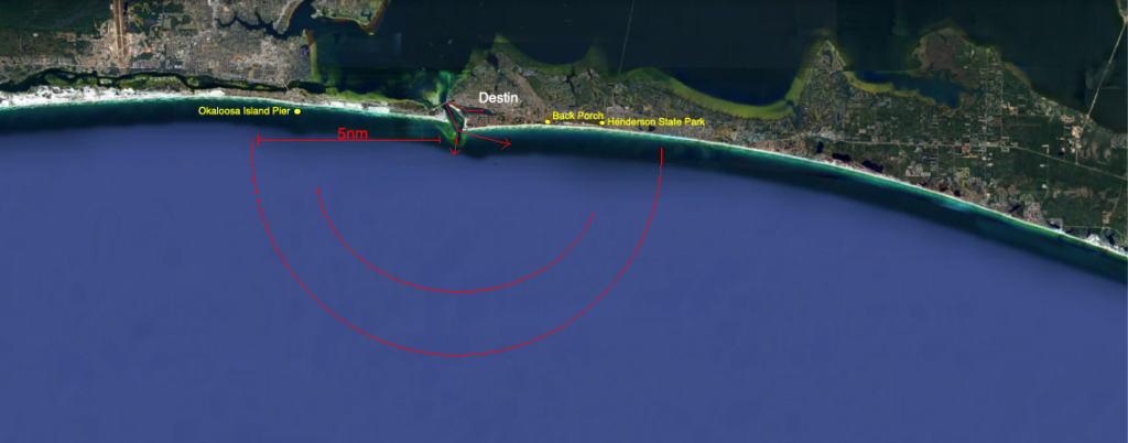
The outside semi circle in red marks the 5 nautical mile distance from the sea buoy outside of the East Pass. The inside red semi circle marks the normal distance the vessel operates within on any normal day time excursion. Only on cruises longer than 4 hours does the vessel approach the 5nm distance range.
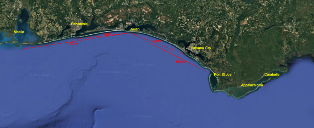
For any fellow sailors cruising the area on vessels taller than 50 feet, take a look at this map I put together detailing NW Florida’s bridge heights. The Destin bridge that separates the East Pass and Choctawhatchee Bay, named the Marler Bridge, has ~55 feet vertical clearance and our vessel requires a minimum of 62 feet clearance. Between Destin and Pensacola, the inland route is blocked by three low bridges marked in red; the Marler Bridge, the Brooks Bridge of Fort Walton Beach (under construction currently, completed 2026) has ~50 feet clearance, and the Navarre Beach Bridge has ~50 feet. All other bridges marked in green have a clearance of ~65 feet. It is worth noting that the inland route marked in yellow between Destin and Panama City is the only way our vessel can enter Choctawhatchee Bay. Of course, always make your own judgements in person, this map is only for reference and does not account for tides or seasons.